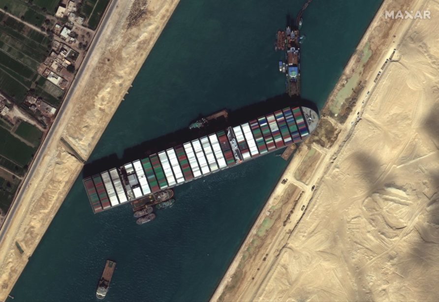
The recent incident in the Suez Canal involving the container ship Ever Given demonstrated just how fast the quality of commercial satellite imagery is improving. What is now freely available not very long ago would have been the sole preserve of a small group of national governments.
The democratisation and commercialisation of satellite imagery are gaining pace.
There are some providers, Maxar, ESA and SSTL to name but three.
15cm HD resolution imagery is now available from Maxar, an upscaling technique designed to improve on the native 30 cm data. It is also highly accurate in positioning against known coordinates.
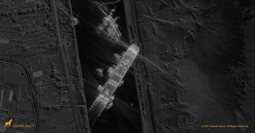
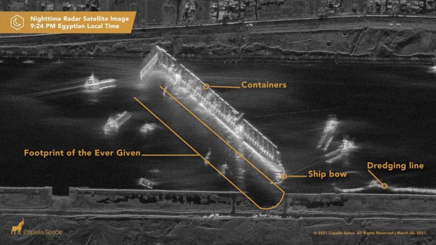
It is not just visible spectrum either, synthetic aperture radar is now also commercially available, the images below were taken at night using the Capella SAR constellation.
The latest 50 cm resolution imagery is in the tweet below
As good as these are, they only scratch the surface of what commercial providers are doing, it is not just about static imagery but analysis with AI tools, change detection and multi-source correlation.
Blacksky, Planet and HawyEye360 are another three sample organisations that can provide additional analytical services in addition to raw imagery.
Related to the earlier post on illegal fishing, HawkEye360 used RF data collected from ships radars and radios to provide data on non-AIS transmitting vessels.
I still find this from our very own Carbonite-2 to be mesmerising
The Royal Navy and wider defence geospatial intelligence groups have been using this type of commercial satellite product for many years. Airbus has been awarded a year-long contract extension by the MoD for maritime surveillance services.
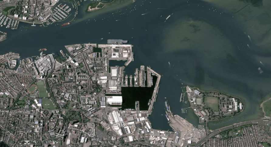
As above, it is the fusing of multiple sources of data that really provides a huge capability uplift over just simple imagery.
The contract follows the successful completion of a proof of concept phase, and will ensure the continued monitoring of areas of interest in UK waters and ultimately protect UK sovereign borders from suspicious vessel activity. Using optical and radar imaging as well as AIS (Automatic Identification System) data, Airbus will provide reports about vessels within the UK Exclusive Economic Zone, as well as information that will help in the prevention of potential illegal activities.
JMSC, which is the UK government’s centre of excellence for maritime security, required a series of services that would provide intelligence to augment their own surveillance activities. Under the agreement, JMSC will benefit from a large range of Airbus’ surveillance and analytics capabilities.
The contract includes, Vessel Detection Reports using SAR data analysis, either delivered in emergency mode for urgently required satellite tasking to monitor suspicious vessels of interest across the globe, or on a twice daily basis for general vessel identification as well as the classification of ‘dark’ vessels in key areas of interest. In addition, the Defence Site Monitoring service, using automated algorithms applied to optical imagery, for the detection, recognition and identification of vessels will detail the evolution of port activity and raise alerts whenever abnormal activity occurs.
The Airbus surveillance services will give JMSC a greater understanding of the various activities across UK waters, especially with a focus on potentially uncooperative vessels, helping to better address security challenges and allowing resources to be rapidly deployed to intercept.
The JMSC also produced an excellent video to explain the wider context
It is incredible stuff, and the defence and security implications are only being revealed. Over-reliance on commercial providers is always a risk worth keeping an eye on, but this new contract extension provides a significant capability we might not ordinarily have.
As usual, see you in the comments

Discover more from Think Defence
Subscribe to get the latest posts sent to your email.

